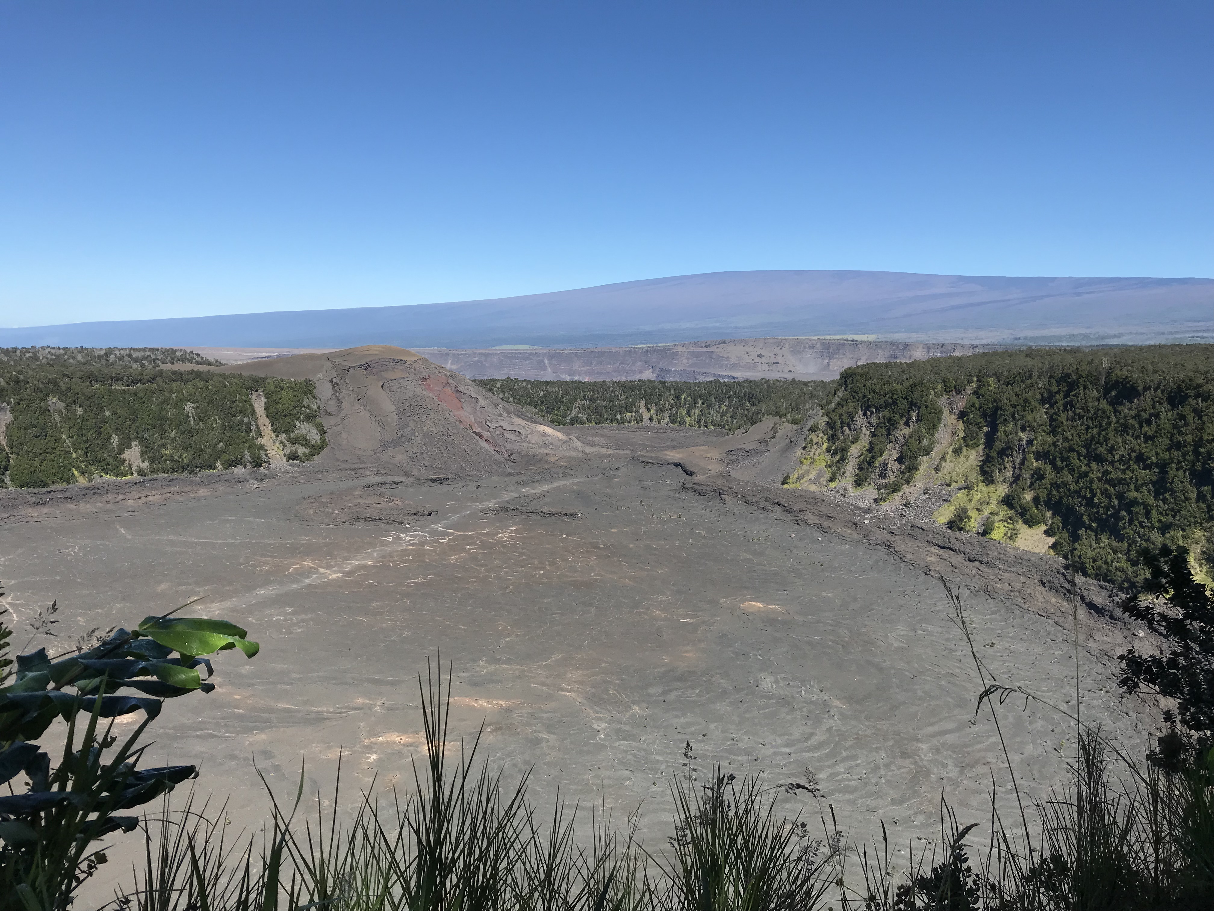
Gray line of the trail crossing Iki Crater, Mauna Loa in the background, Kilauea just over the far ridge. 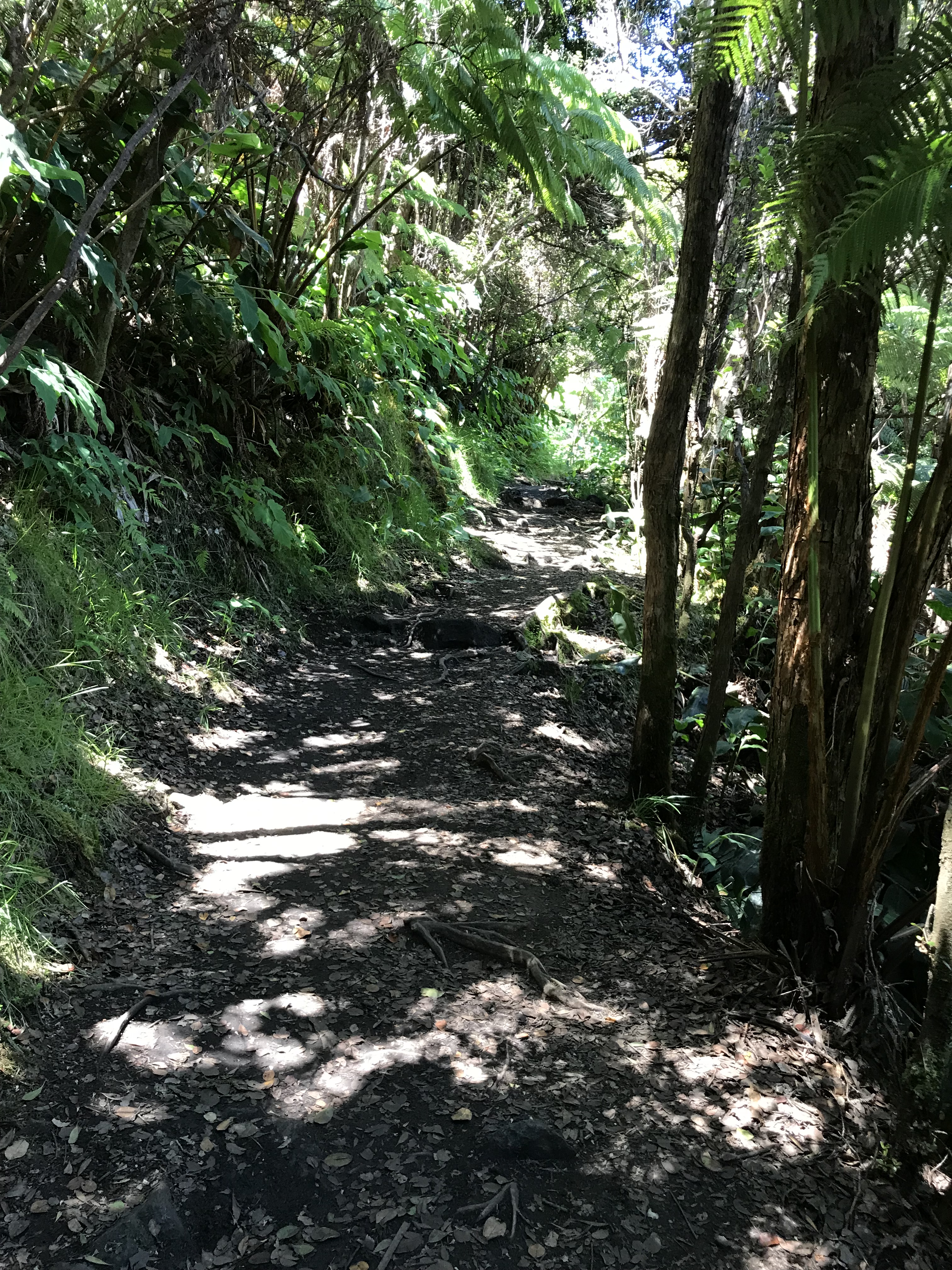
The hike down to the crater from the rim, a 400′ elevation change 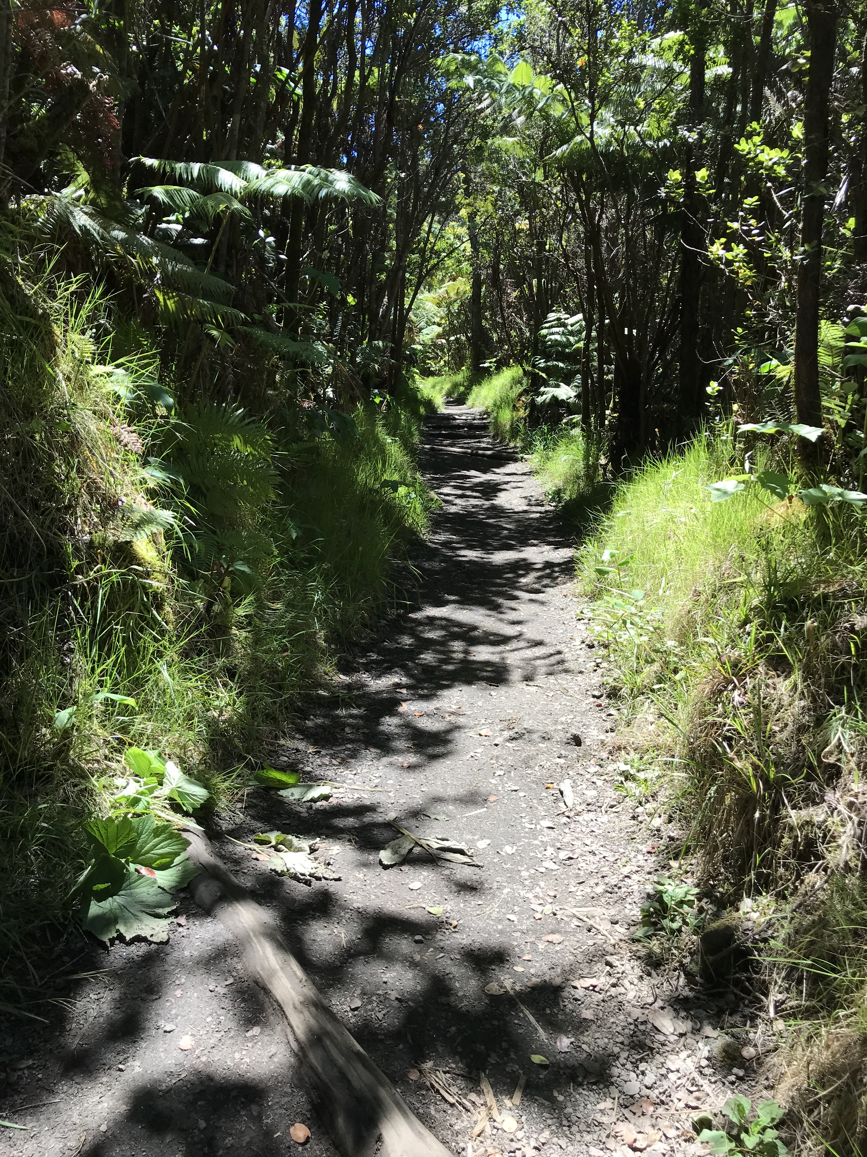
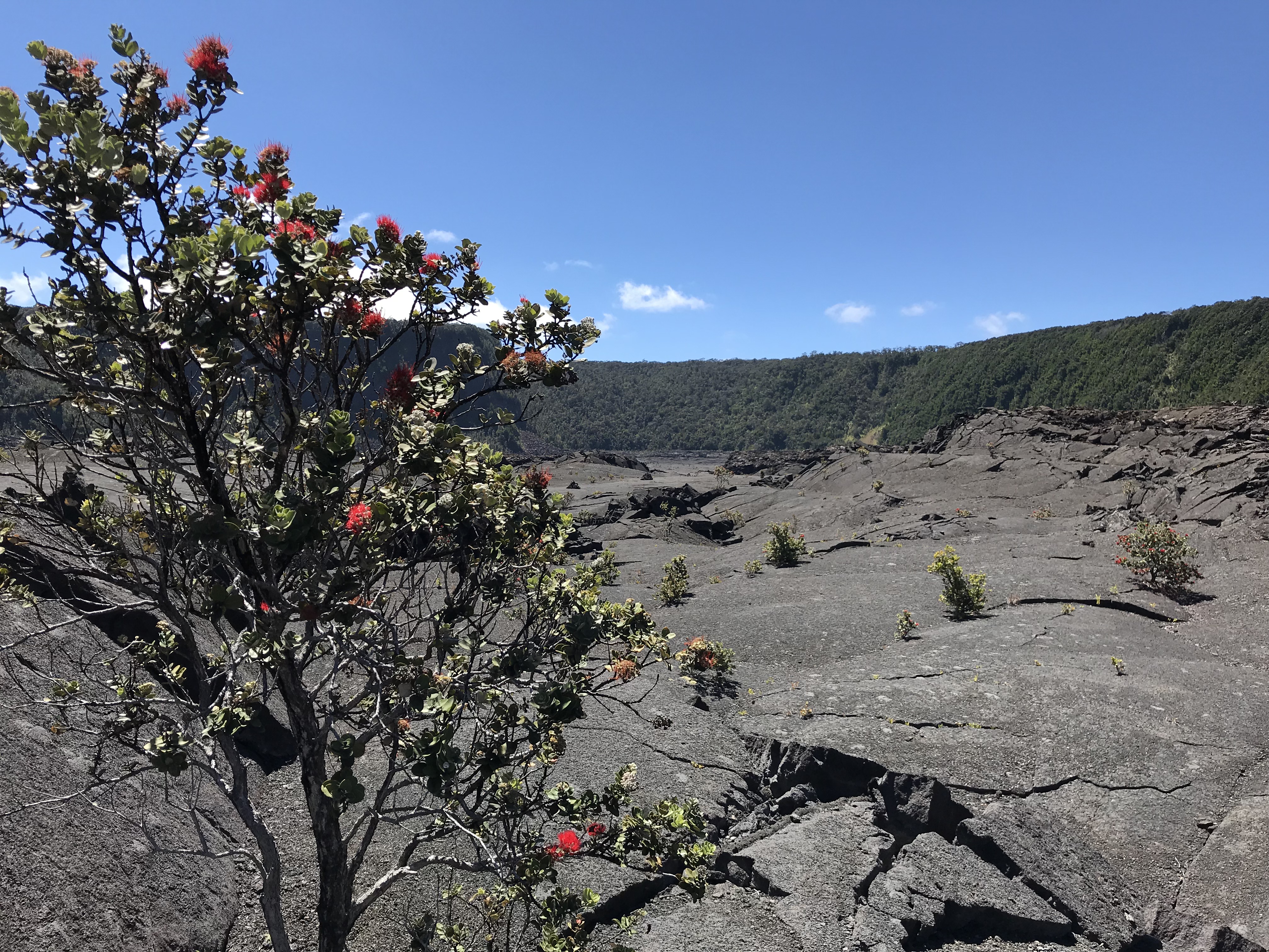
Down on Iki Crater looking East toward the trail head. 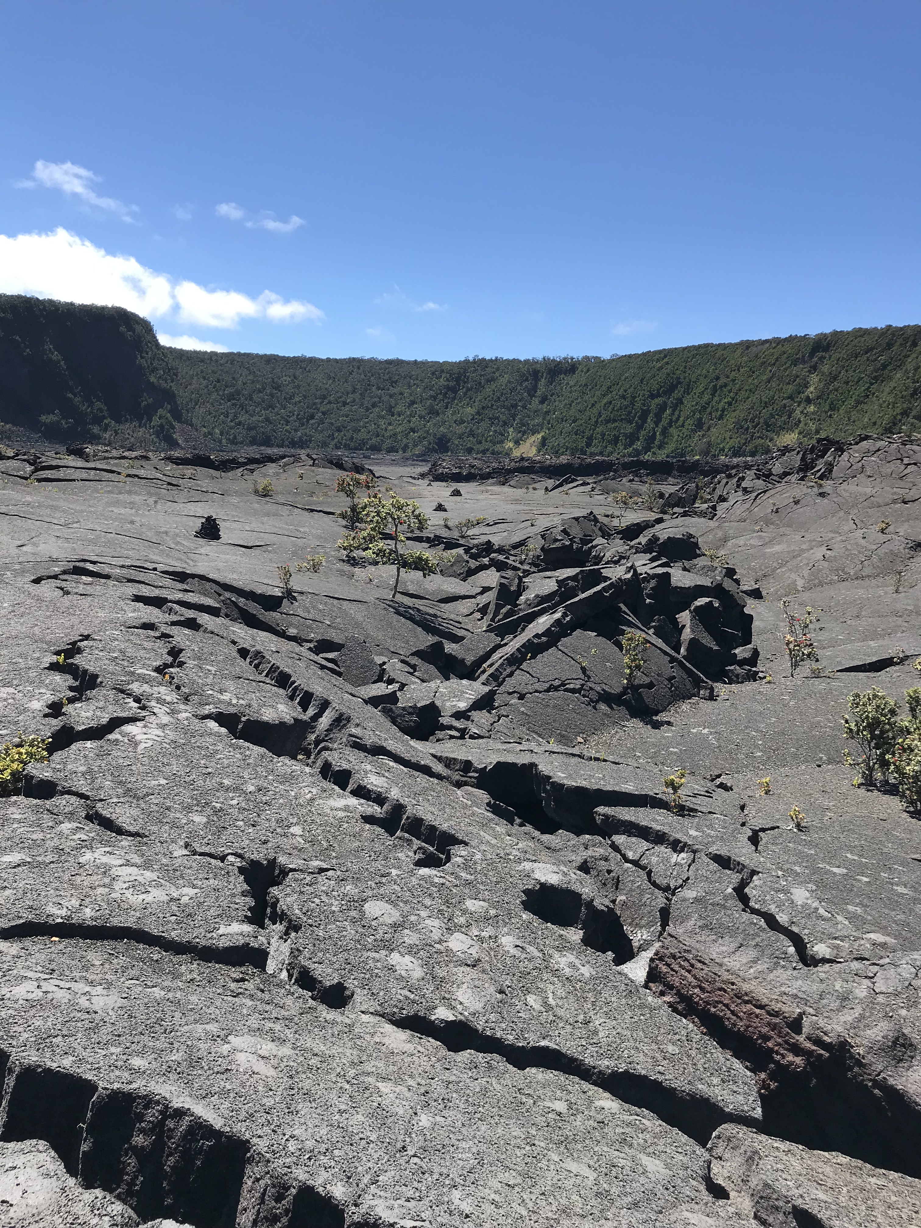
Looking East from the far side. Not that one would lose their way, the cairns are a guide for the safest path to follow as at parts the crater surface is much like this.
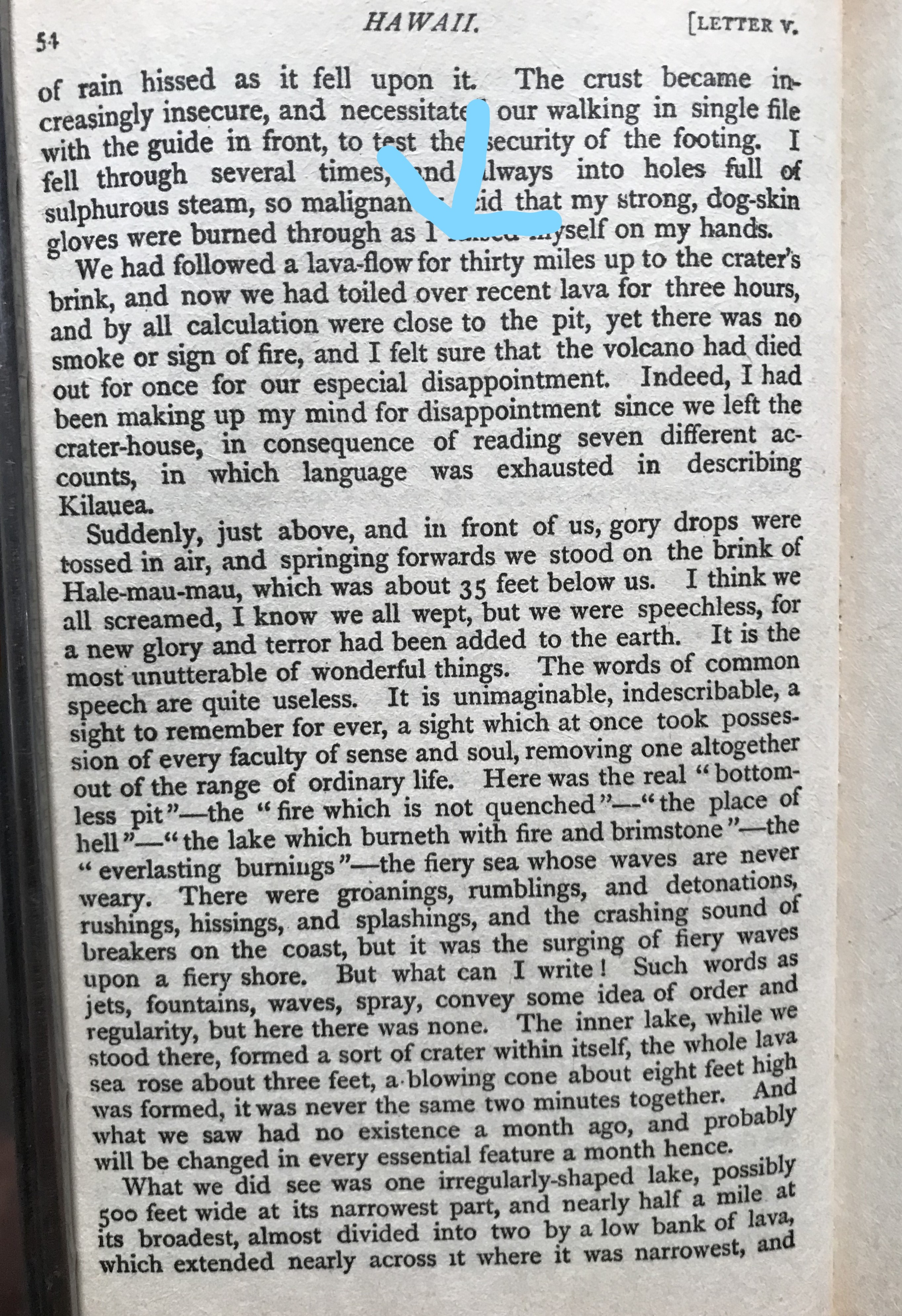
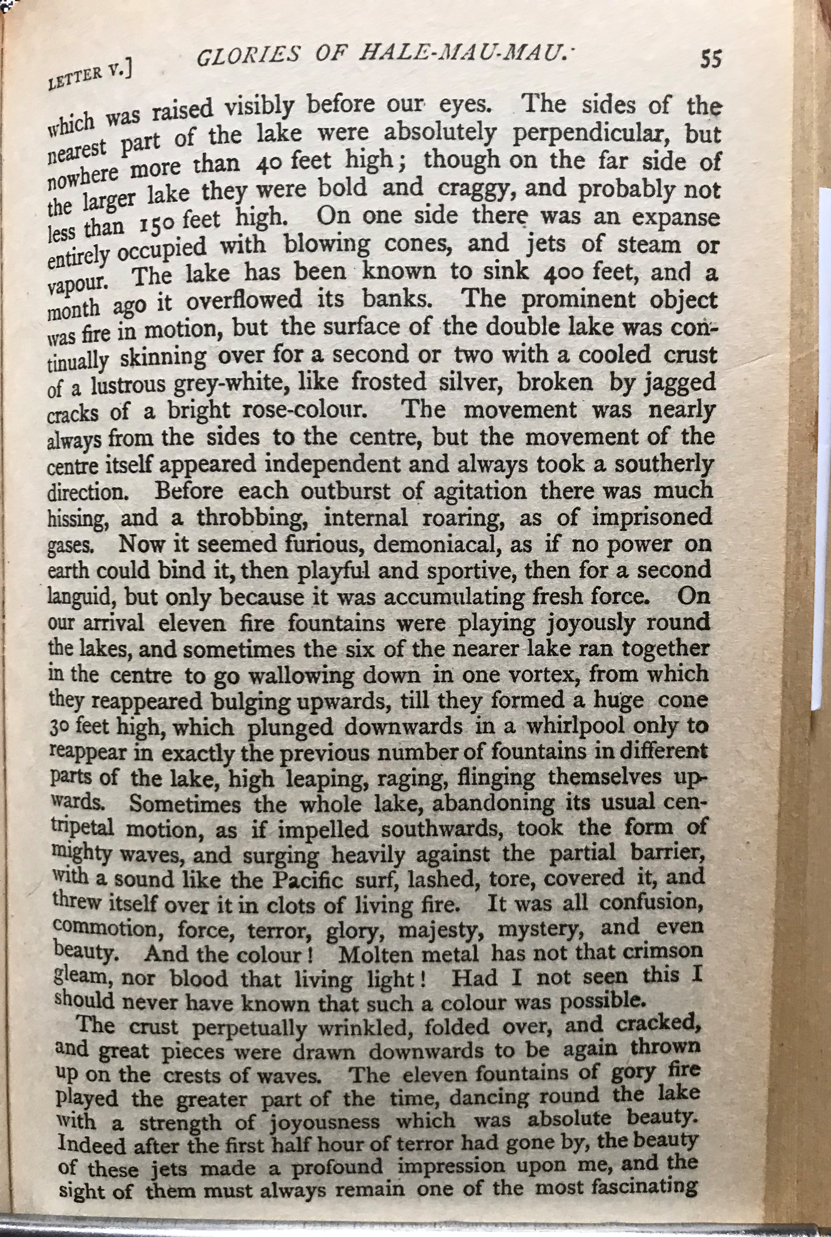
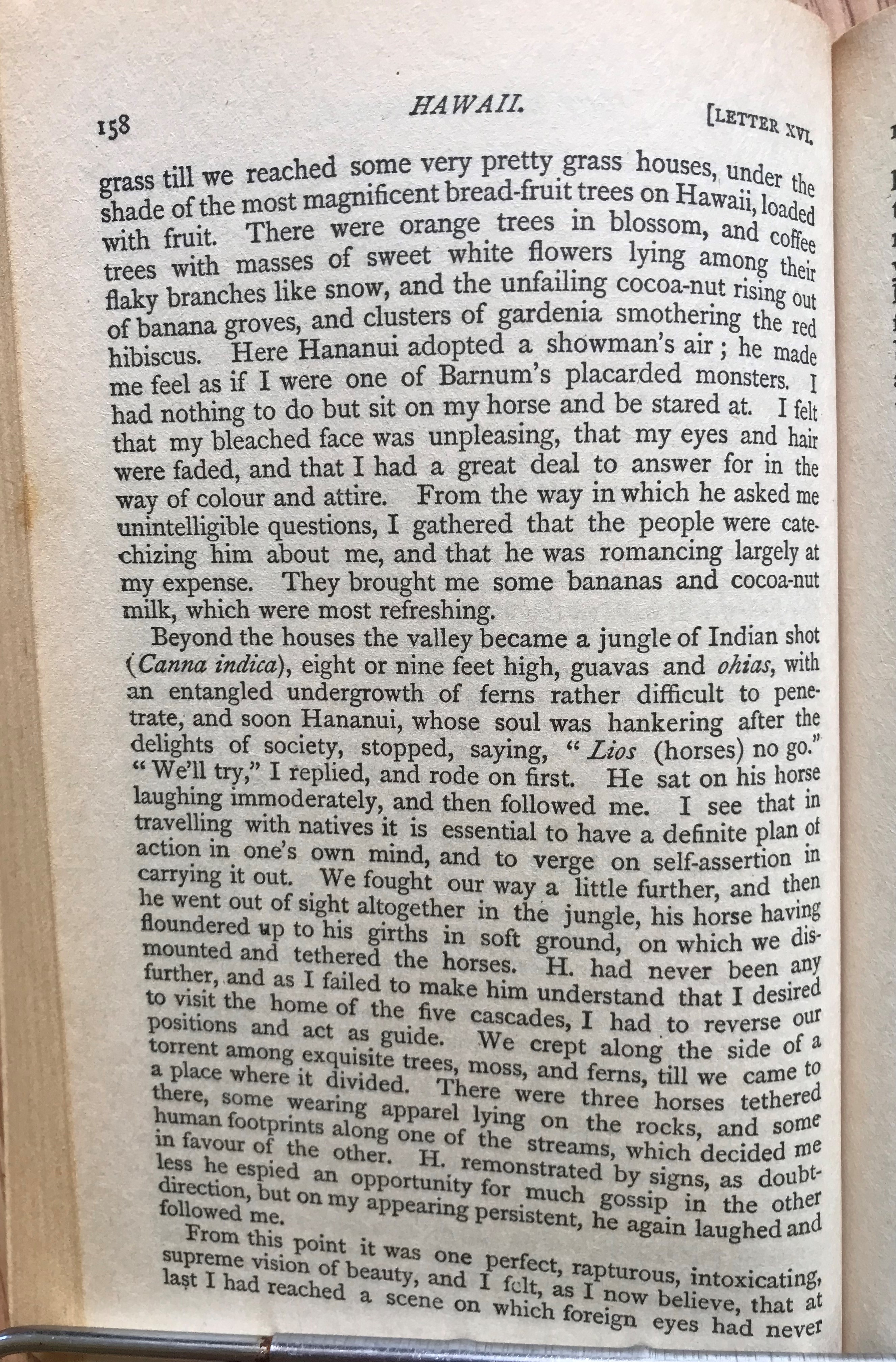
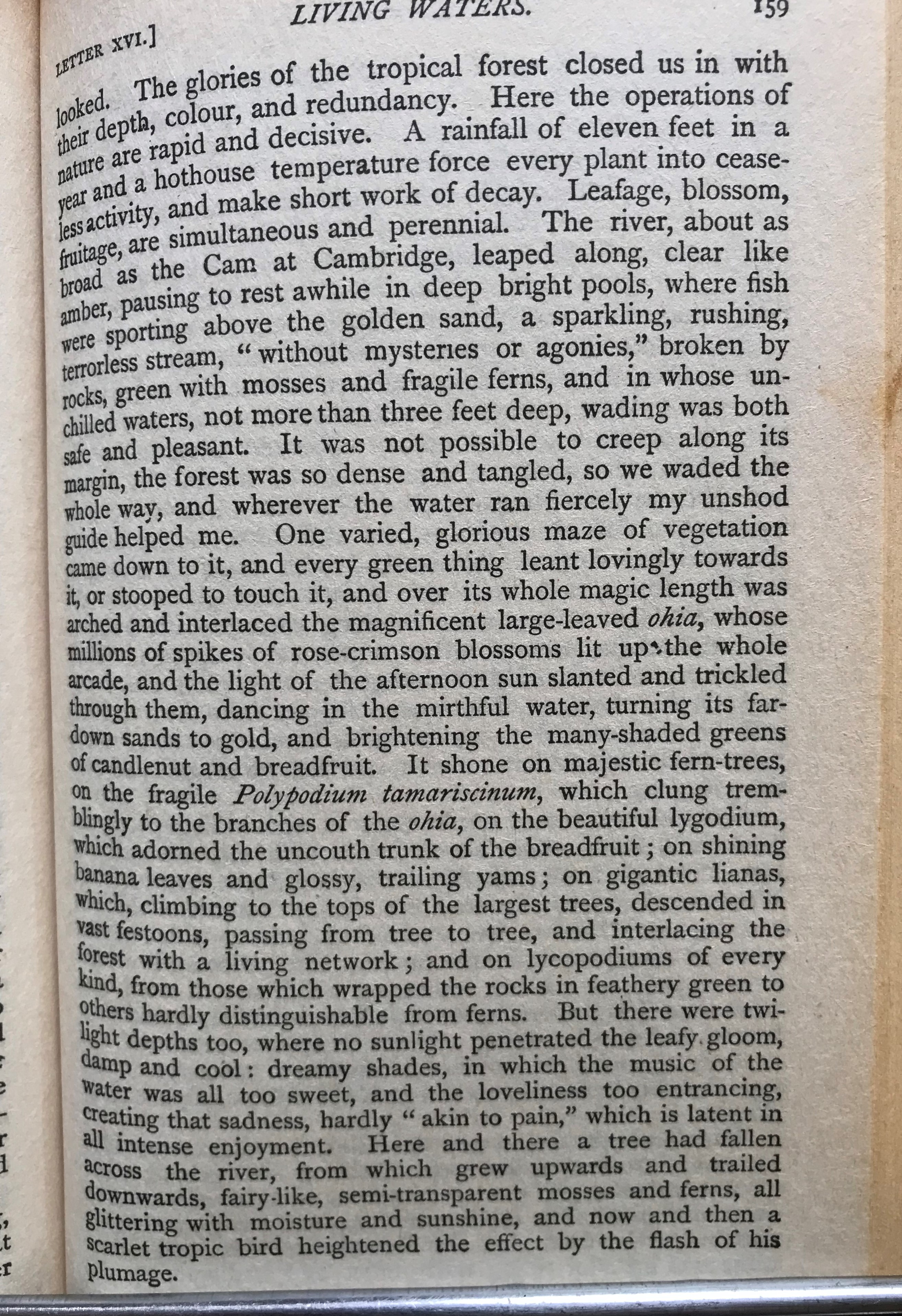
I leave tomorrow from my 3 week stay here in Ocean View at the south end of the Big Island moving back to Kailua-Kona until the 22nd. I started my visit last May at quiet Hawi on the north end and comparing that time to this Ocean View is more remote, quieter, if that was possible, fewer neighbors, and a seemingly darker night which helps to see more of the Milky Way and a star filled sky. There have been more places to hike though fewer beaches to swim, no restaurants even though the “town” center with the grocery stores are more convenient. Everywhere I’ve gone in Hawaii since arriving back in April I have found almost everyone I met to be pleasant and nice. Last July 4th weekend I had a nice conversation with a yoga teacher from Vienna VA followed by the next day one with a hitch hiking surveyor who in 1973 laid out lots in the subdivision where the house I’m staying was built. That same day I met the yoga teacher I help a fisherman hook his trailer up to his truck and within a few sentences asks me if I’m from Maryland. All this time I thought I had a Scottish accent. Eh, mate? There are friendly critters everywhere. Dogs sleeping in the middle of the road or patrolling their property with suspicious alertness and of course roosters crowing at a more reasonable hour though still before first light. My cat companion who lives under the house, wary of me, watching, keeping a distance is at times an annoying night explorer. I hear it moving things under the house or sometimes playing on the front porch with a friend. This house is on a lot cut out of a 40 acre square on the side of Mauna Loa tucked in between the flows from the 1907 eruption. Except for the nearby hike in the State Park where on a wet morning the masquitos where a bother my other hikes here are what I was looking for. On the slopes of Mauna Loa I’m walking either up a hill or down compared to walking along the ocean side, parallel to the shore, on generally flat ground. Sunday, July 7th, I drove to Volcanoes Park Kilauea Visitor Center to hike the Iki Crater, best to do this before noon though many times on my visit wherever I’ve hiked I see folks with young children hiking up and down the slopes at all times of the day. It takes me about an hour to hike 2 1/2 miles on Hawaii’s slopes, taking an even pace up, down and on the flat at the far end looking back toward the parking lot I imagine what it might have been like to cross the Iki crater and stand at the rim of Kilauea (the volcano is active still but you are not able to view an open pit as it’s now covered over). In 1873 Isabella Bird made the 30 mile horseback trip from Hilo, she writes about not knowing what to expect:
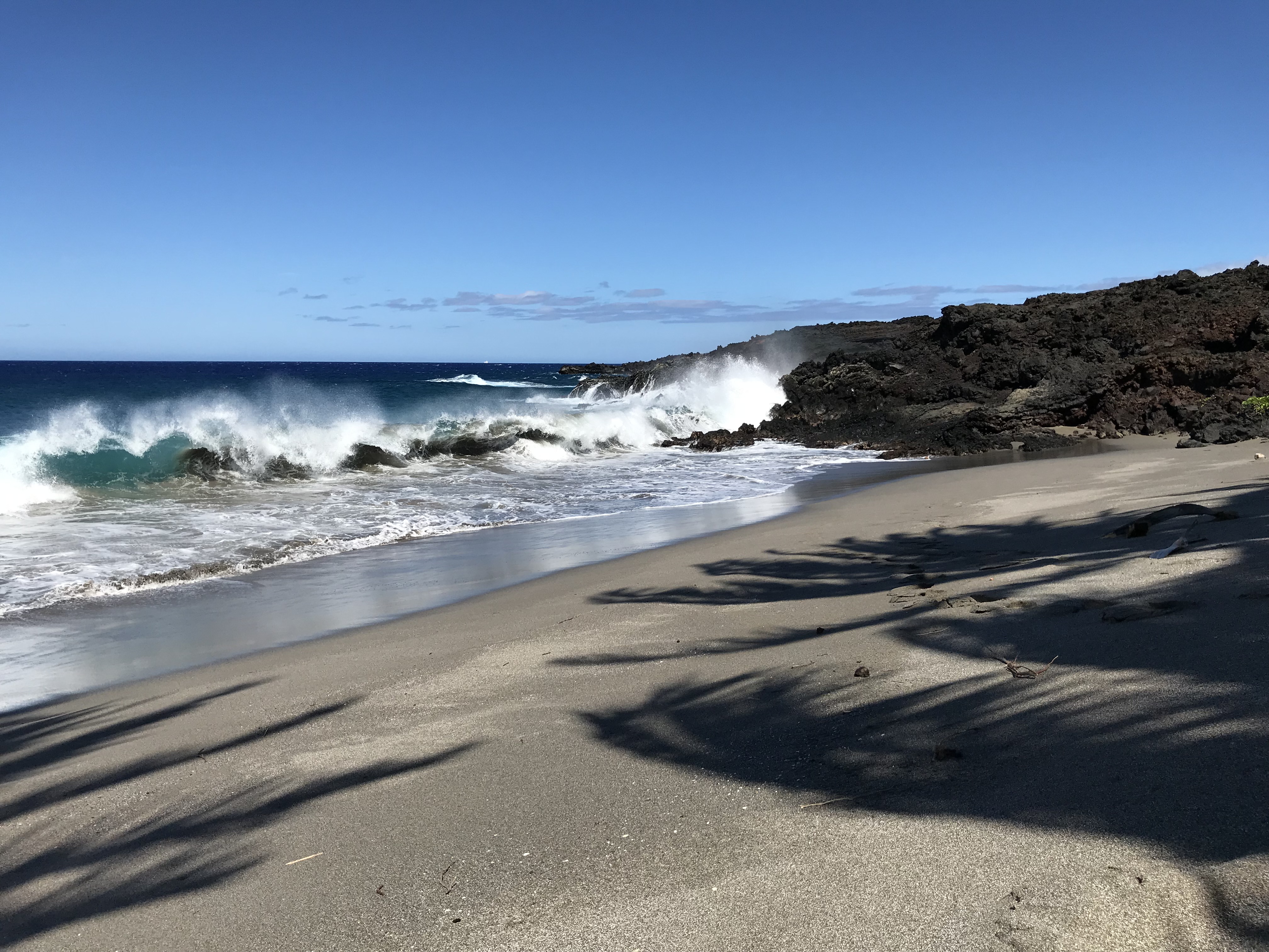
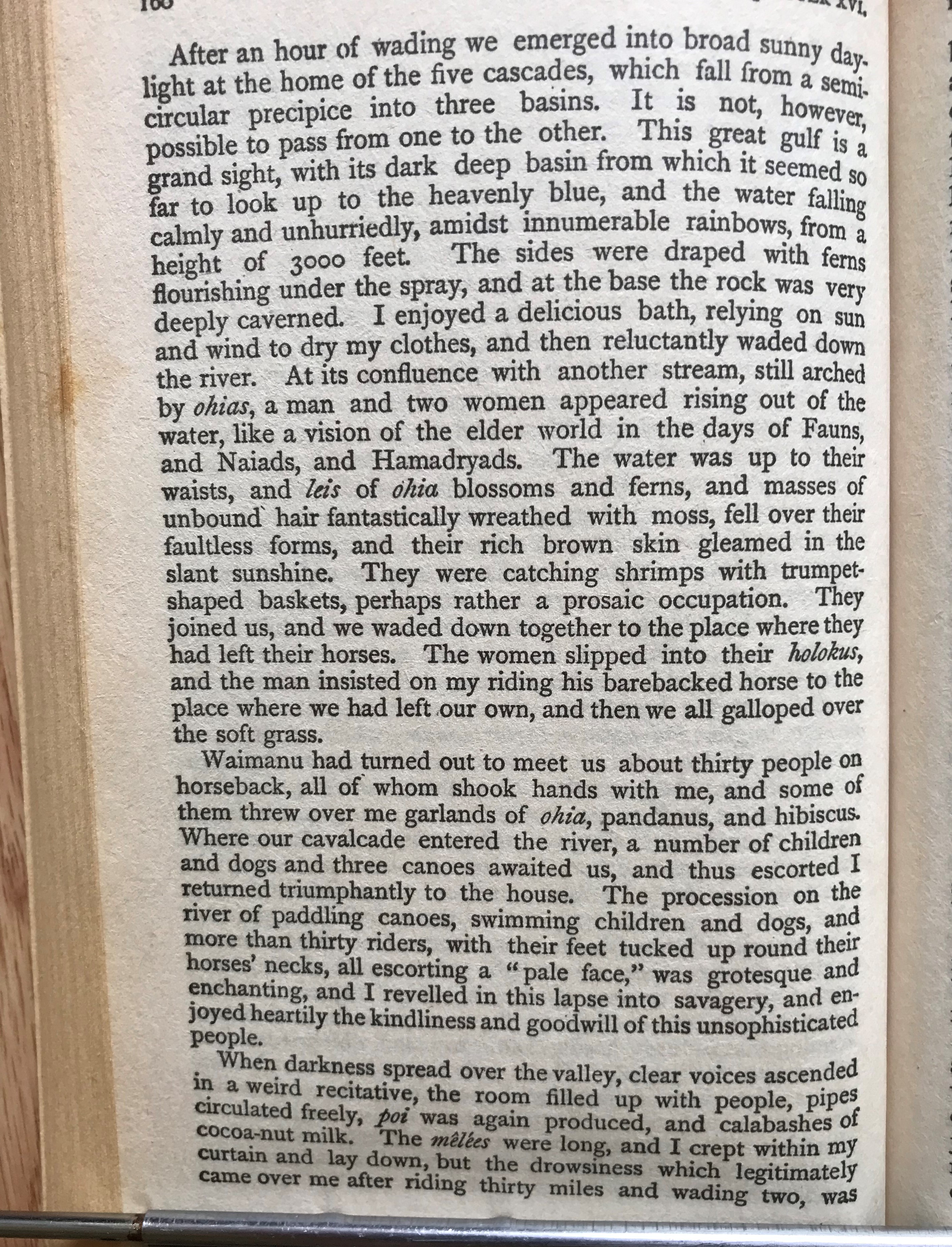
The weather, like the sky and the ocean, changes hourly. The forecast can be relied on to some degree (ha, ha) but should really be confirmed by looking at the sky. That said, planning the hikes I wanted to take before leaving depended on sunshine. The day before the Iki Crater hike I drove to the end of a road in the across the highway subdivision from the one where I’m staying to make the trek to secluded Pohue Bay. The 2 1/2 mile hike to the beach is entirely over the 1907 lava flow, nothing grows except a few scrub O’hia “shrubs”. I cross paths with a small herd of wild sheep (Mouflon, Mediterranean sheep) as I follow along what was a 4 wheel drive path, making a hard turn left close to the ocean to continue on parallel to the water for a 1/4 mile where I find this lovely beach which I later find out is a Hawksbill turtle hatching ground. I spend an hour sharing the beach with no one, it’s beautiful and peaceful. The surf is too rough to swim alone and I’m not willing to risk an accident putting me out of commission for any time I’m here. Just being there on the sand under the shade of the coconut trees looking at the ocean, the beach and a sailboat moving along is enough. On leaving I meet 2 UH research students keeping watch over the turtle nests and am told they are soon to hatch! The nests are covered with chicken wire cages as even in this out of the way place mongoose and rats find what they are looking for. On the walk back a family comes by in a jeep (taking them 1/2 way), I wave, and another who have been to the beach many times are packing up their gear for the walk in. Not a secret to the dedicated trekker.
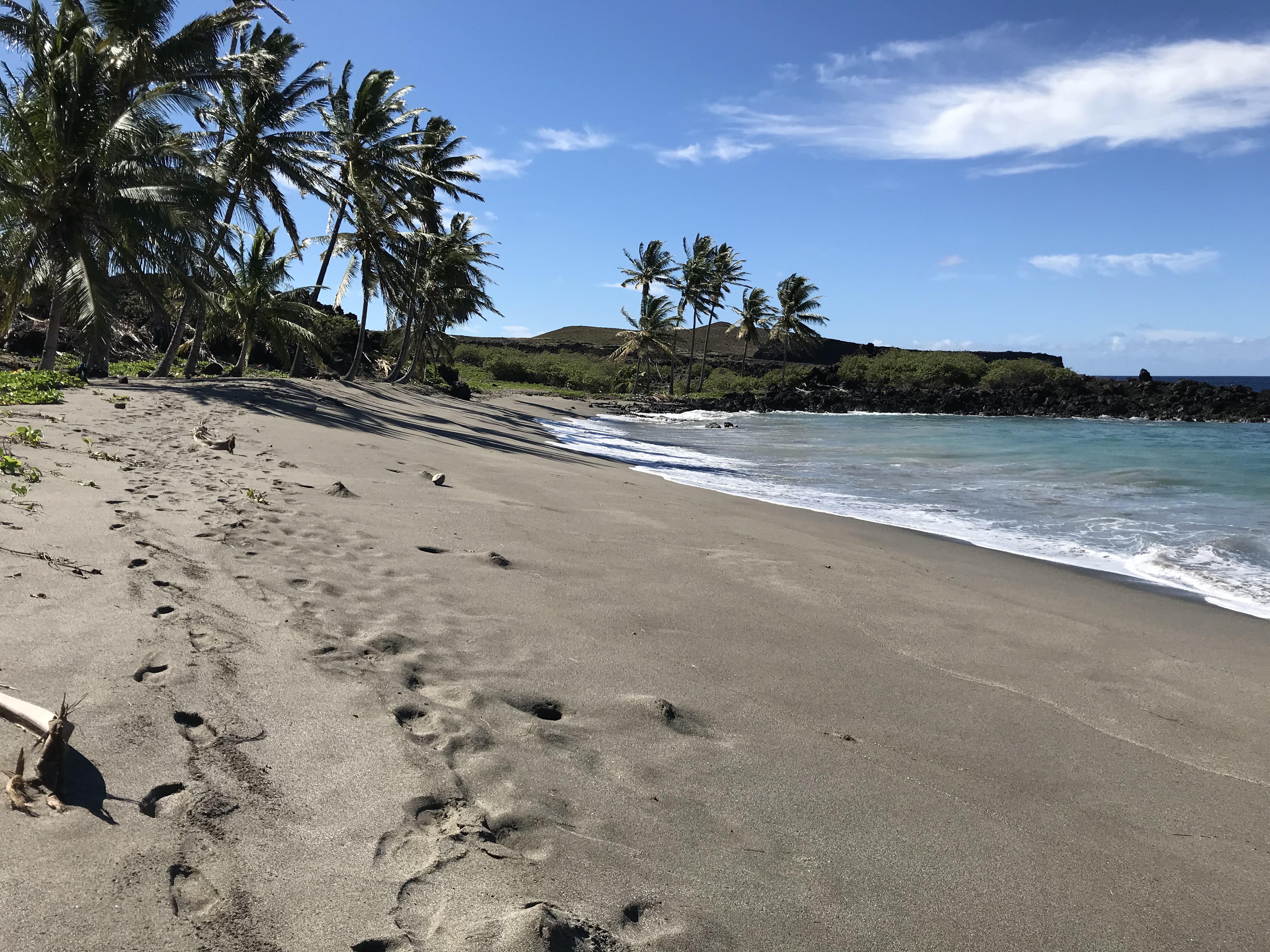
Pohue Bay beach. 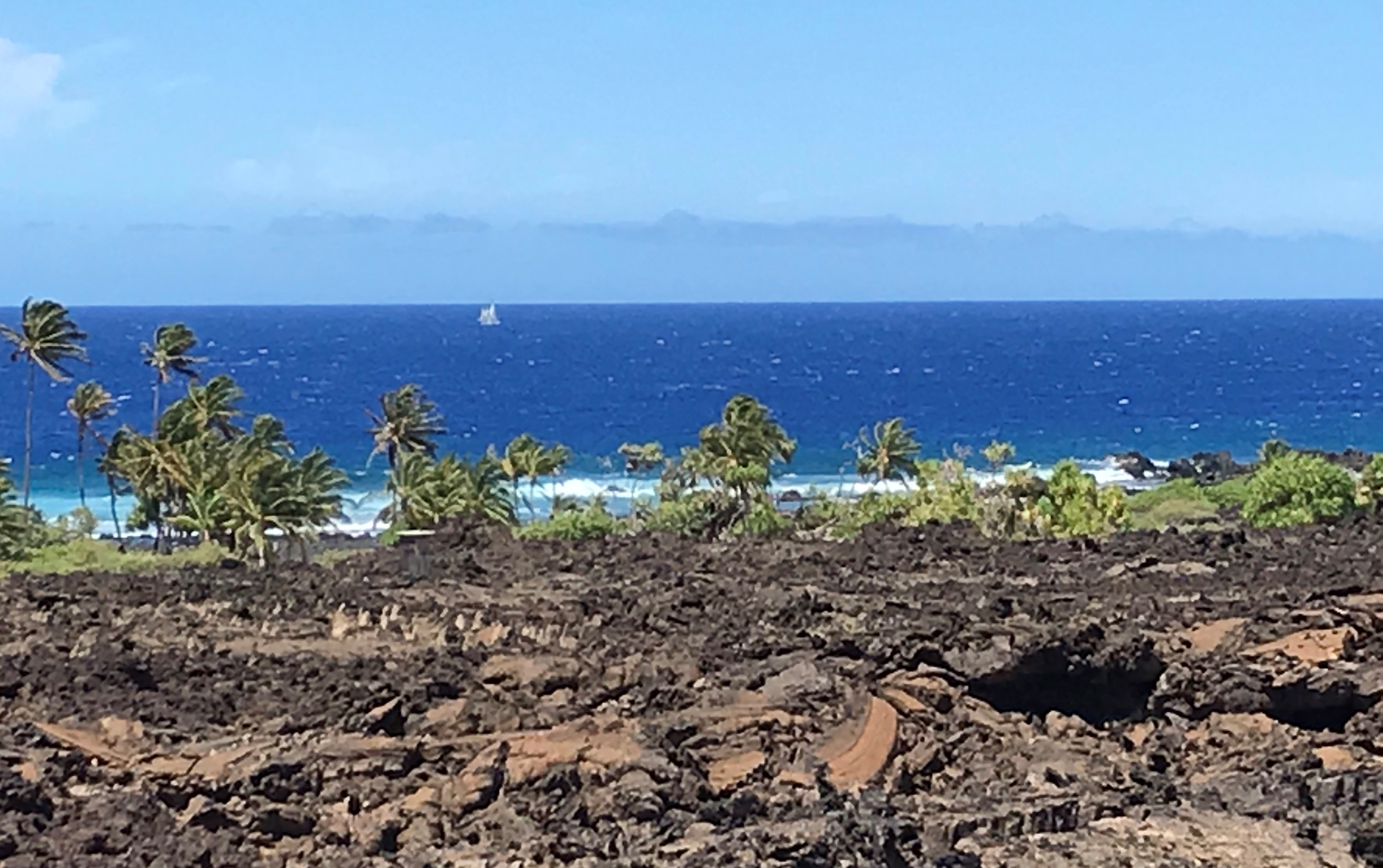
https://www.youtube.com/watch?time_continue=17&v=bes4feCY4Ms 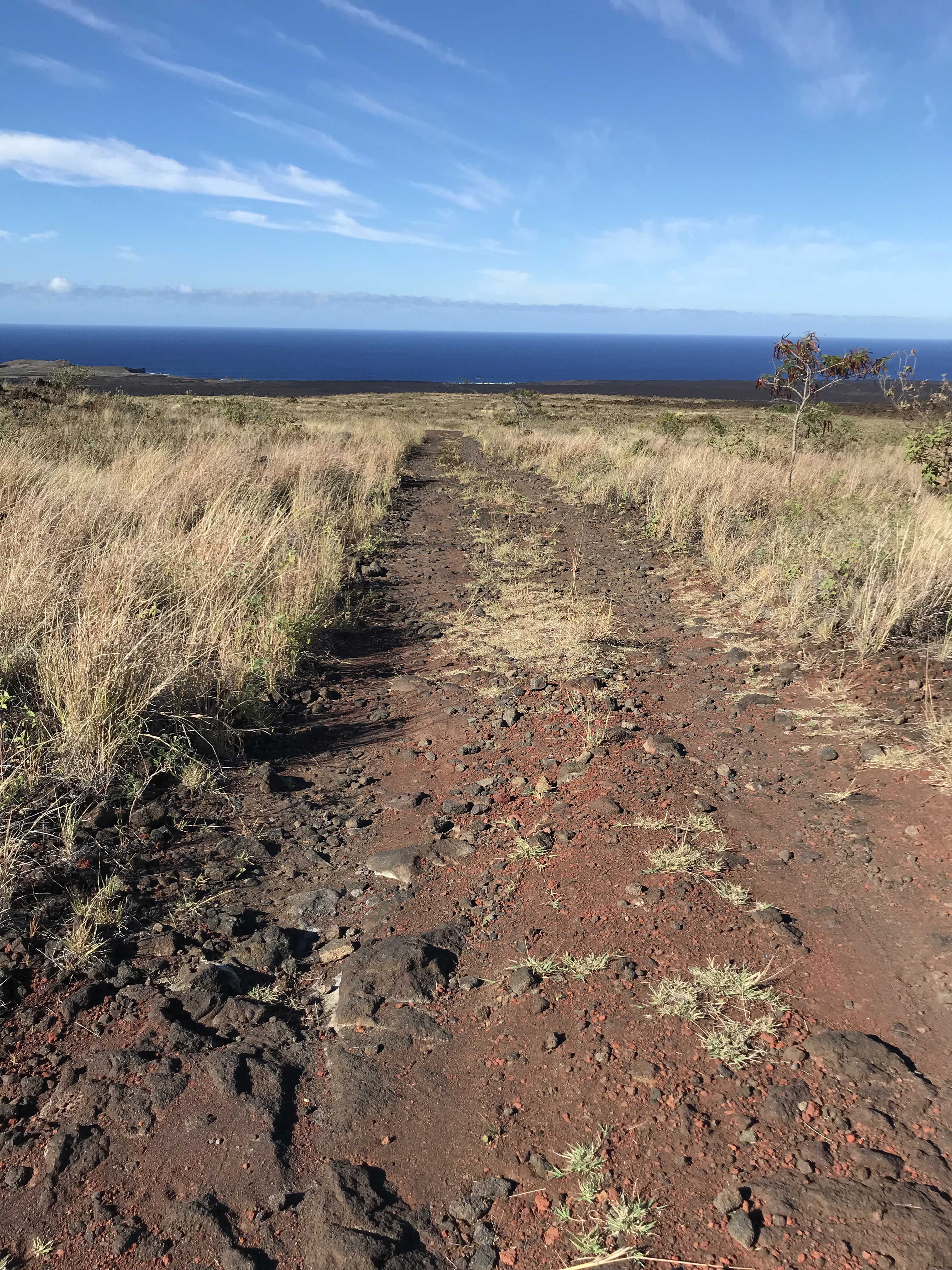
Near the top of the trail, 600′ elevation change, 2 1/2 mile hike, the beach is just to the left of the trail.
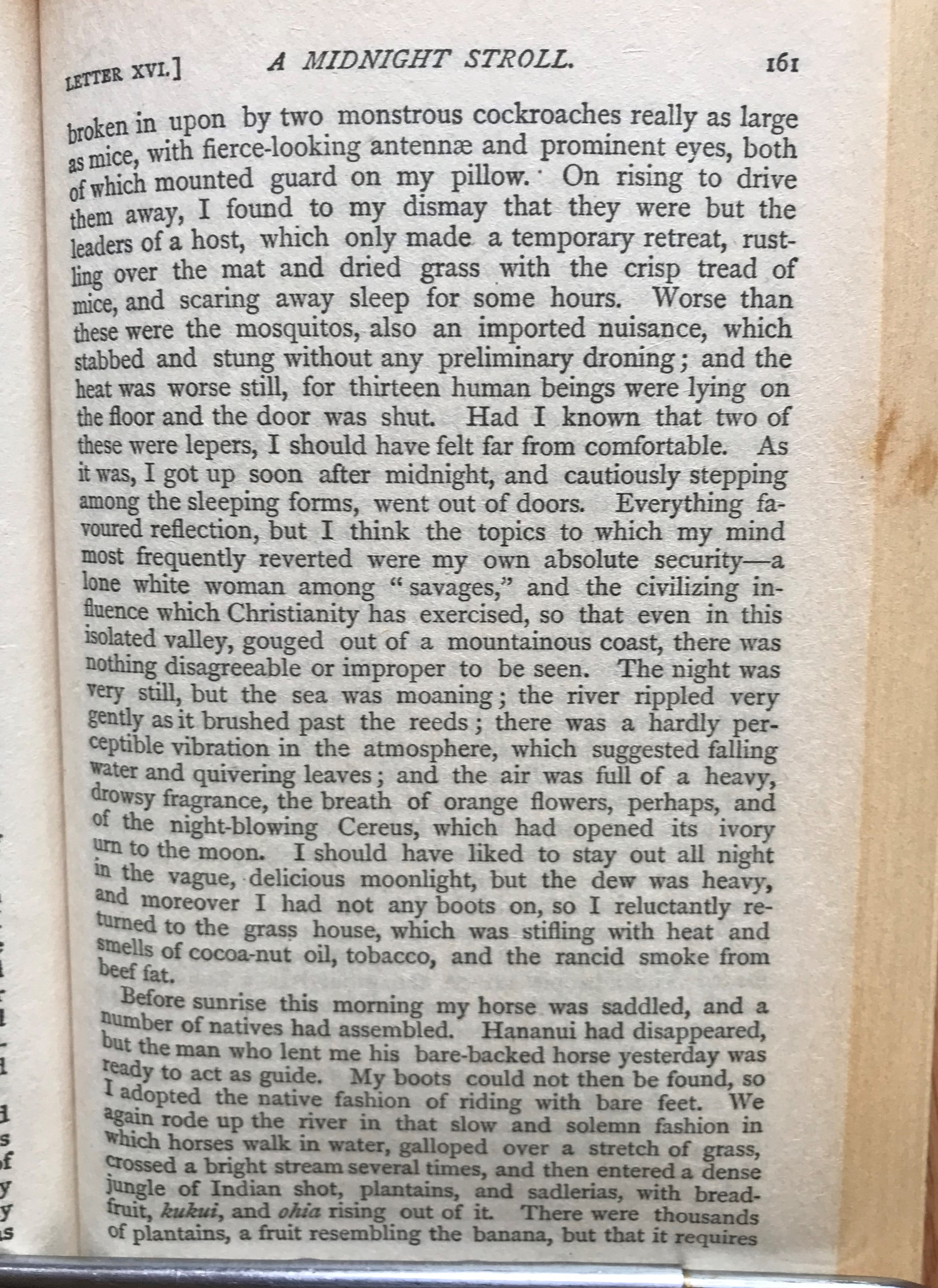
I have not spent a day on my trip without wonder at what I see on these islands. The photo below of the wind farm sitting on a plateau 400′ straight down to the ocean catches my eye whenever I drive past. I imagine the lava flow that formed such a shape and find from my map that there is no record for the flow that the wind mills sit upon but the ground at the base of the cliff is made up from the 1868 flow that swallowed Robert Brown’s farm and nearly his family. I wonder if there was a bay the 1868 flow filled in and if there was what did it look like with such high walls of lava guarding it’s flank? When on a trip to the South Point I wander over to a fisherman’s tent and asked how he catches anything with his lines 30 feet above the water with the rocky shore beaten by a shifting tide and surf and he tells me that the fishermen tie a kite like set up to the end of their lines and let the wind pull the bag with hooked end out over the water and when it’s out far enough they pull the kite in and let the line drop. I notice a plastic bat tied on the end of the rod and he tells me when the bat gets yanked up/down? (not sure which) he knows that there is something on the end, reeling the fish in a zip line set up with a fish gaff hoked on slips down to snag the catch which is hauled up 30 plus feet to where he’s standing. Do you sell your catch? I ask and he, like others I’ve talked to, gives away to family and friends what isn’t kept https://www.nps.gov/havo/planyourvisit/upload/Puu-o-Lokuana-Trail-Guide.pdf
Annie Brown Spencer wrote of the 1868 eruption: “Over 3,000 earthquake shocks in 12 days…. No words of mine can do it justice.” March 29, 1868 – “A dreadful night. Heard from Kahuku – the house is in ruins. Poor Mother was terribly nervous, but kept up bravely. A fow was reported on the mountains.”
April 1, 1868 – “Last night the shocks were many and hard, consequently our rest was much broken. God only knows how long it will last. We are going to Kahuku tomorrow to get some books.” April 2, 1868 – “We went to Kahuku. All the folks were well and very much pleased to see us. In the poor old house, walls were broken, with cracks a foot wide and furniture was sliding toward the center of the foor. I managed to wrest open the bookcase and get quite a number of books. Mother was afraid the walls would fall in and injure us. After we returned home, there was a most frightful earthquake…..absolutely impossible to stand or walk. Punaluu and Honuapo [nearby coastal towns] are desolate. A tidal wave swept all away. Many lives are lost. There have been terrible landslides, with 30 people buried inside of a minute. The earth is in constant tremor. All our houses are much shattered but we thank God that none of us are injured. Oh, it is terrible.” https://www.nps.gov/havo/planyourvisit/upload/Puu-o-Lokuana-Trail-Guide.pdf
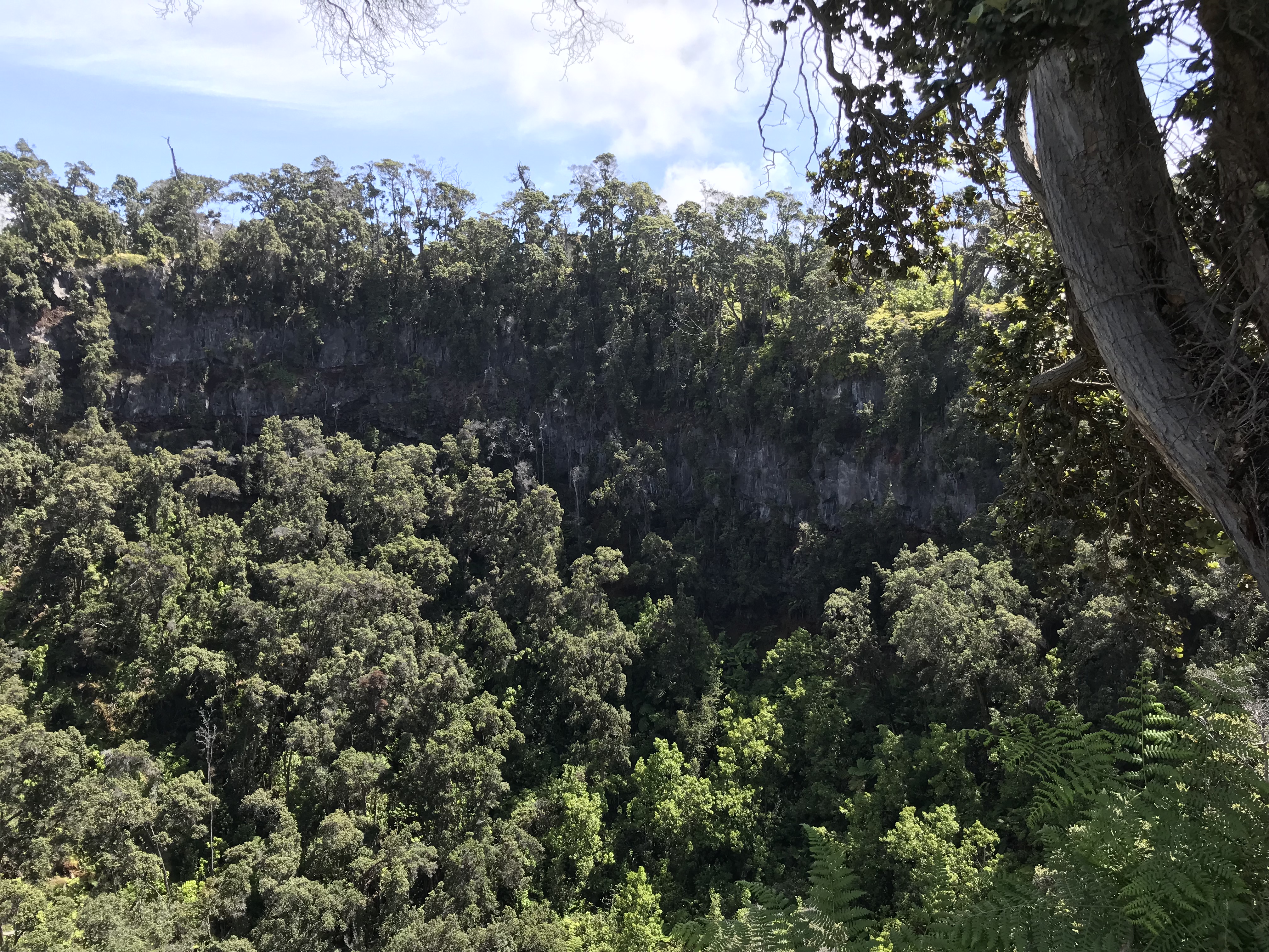
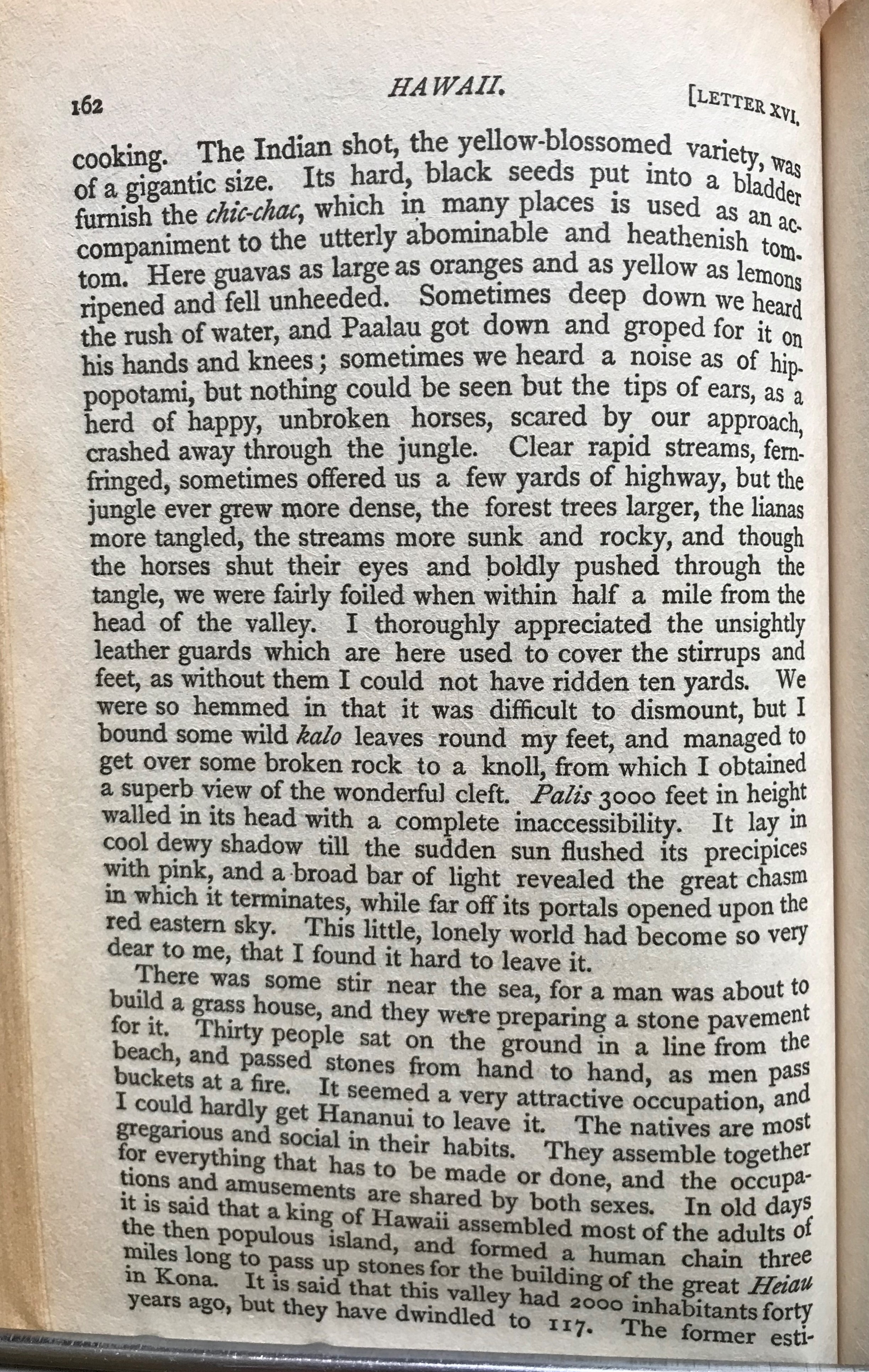
Forested pit crater – Kahuku Unit of Volcanoes National Park
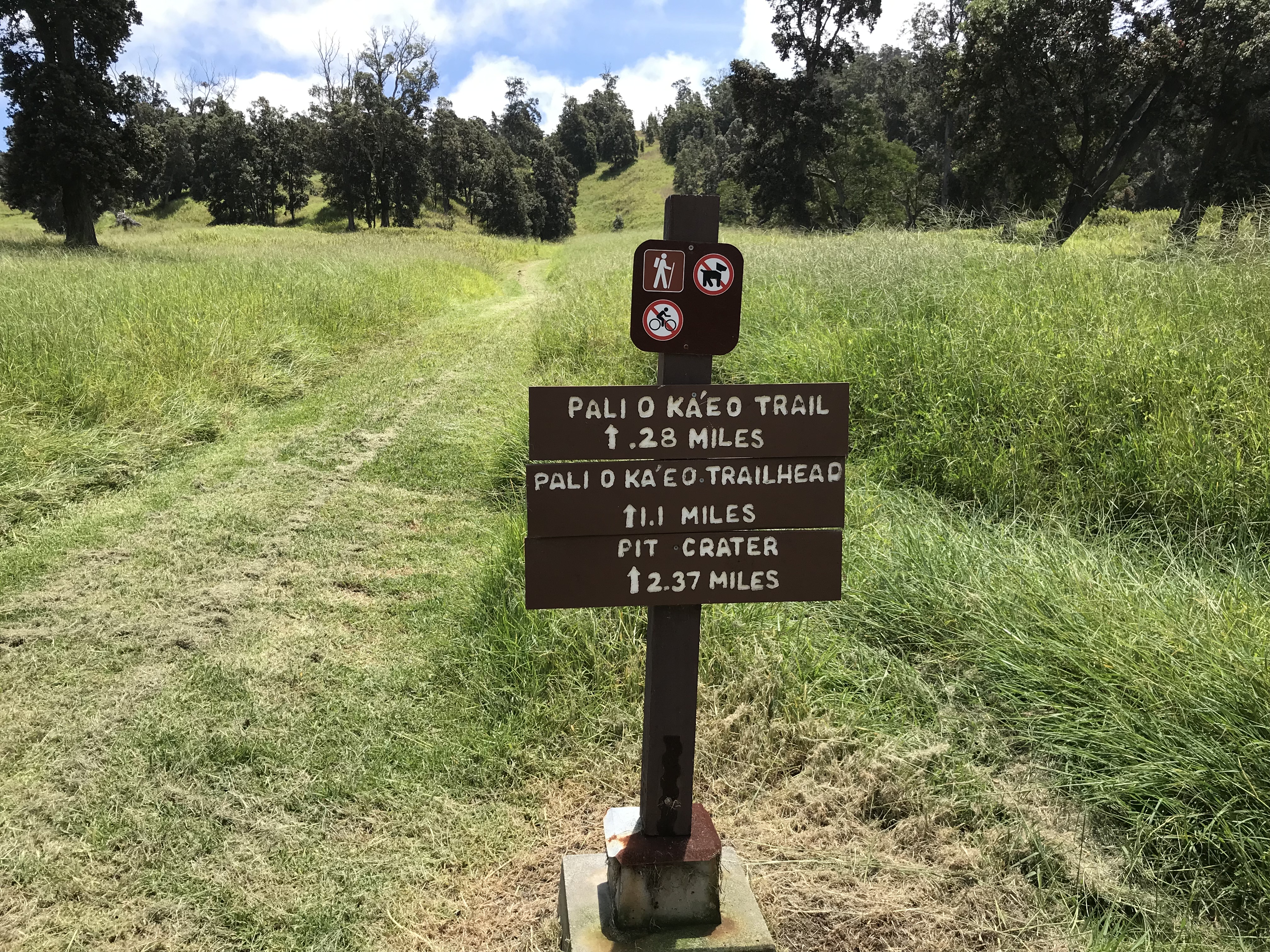
https://www.nps.gov/havo/learn/news/20180917_pr_pit_crater_trail.htm 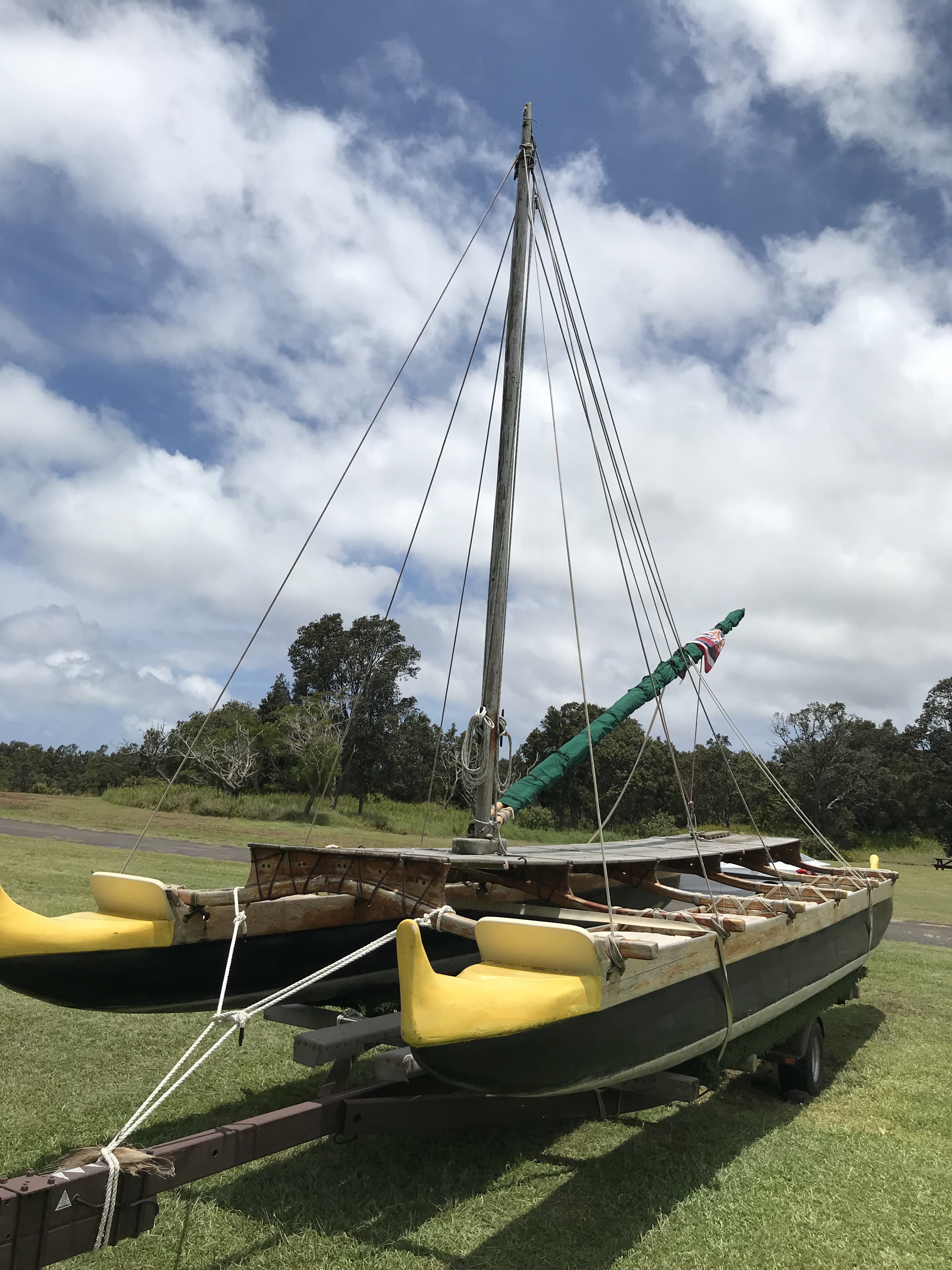
Double hulled canoe -http://archive.hokulea.com/ike/kalai_waa/kane_evolution_hawaiian_canoe.html 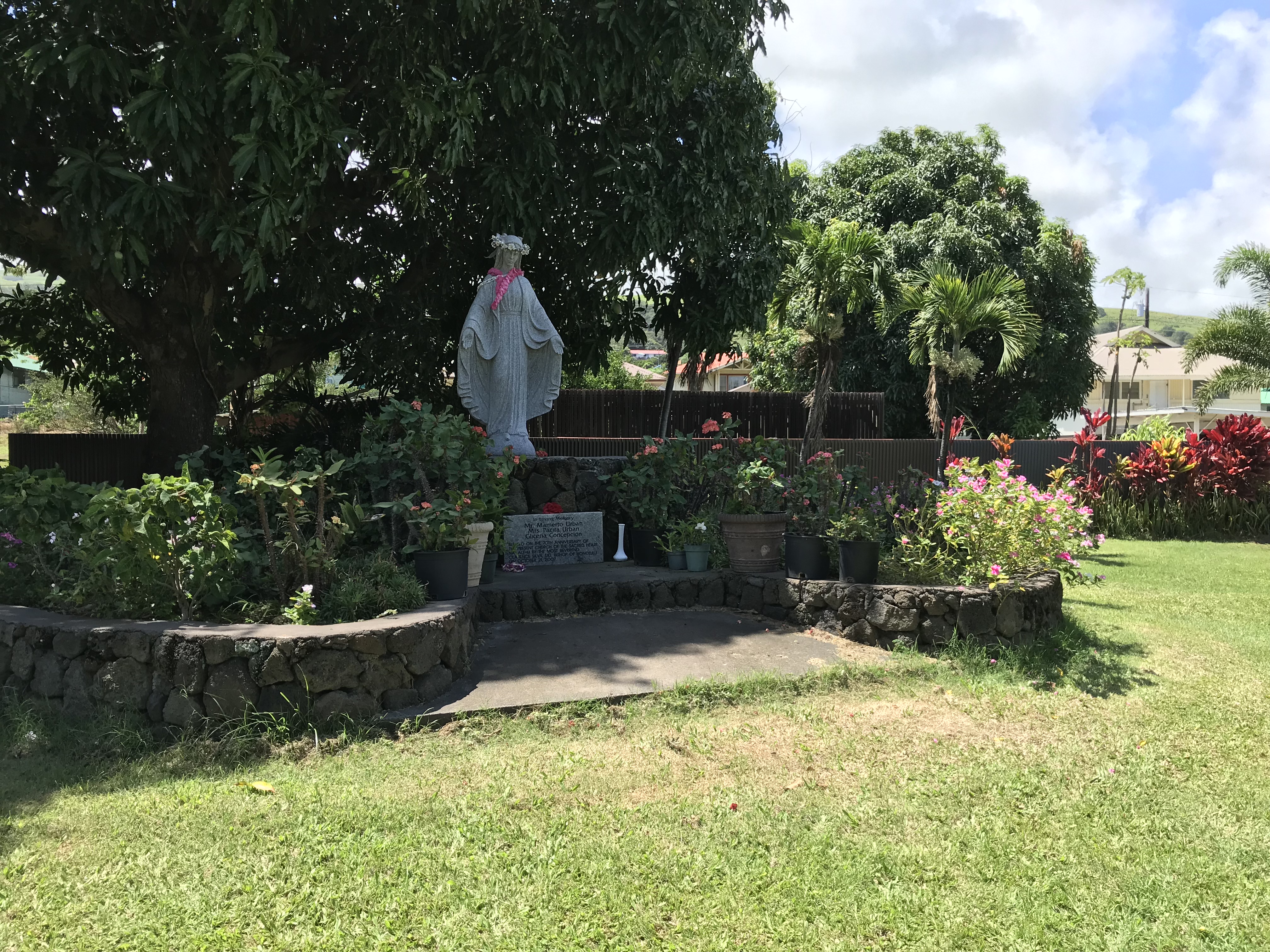
Garden at Sacred Heart Church in Naalehu. 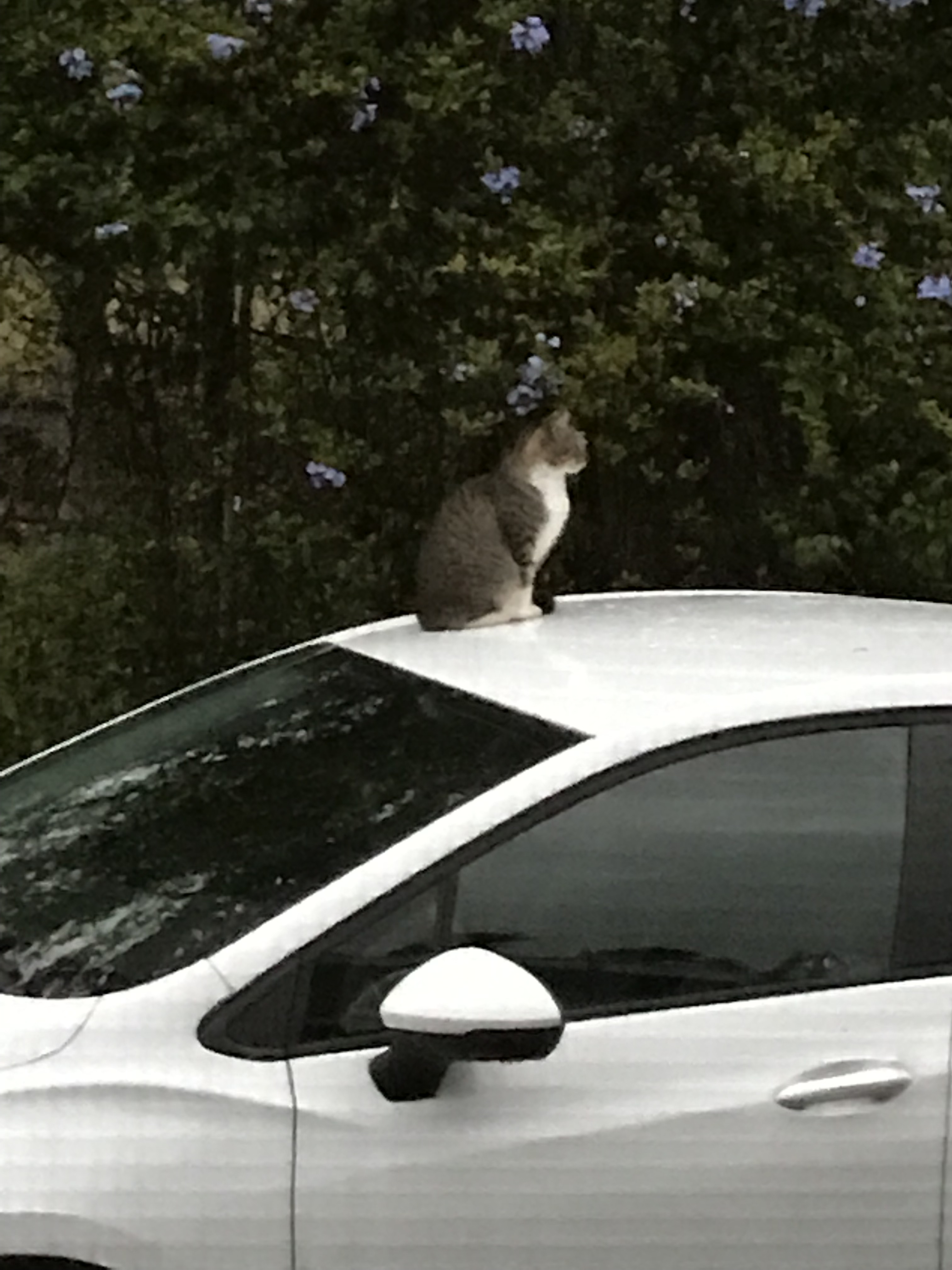
“Frankie” kat. 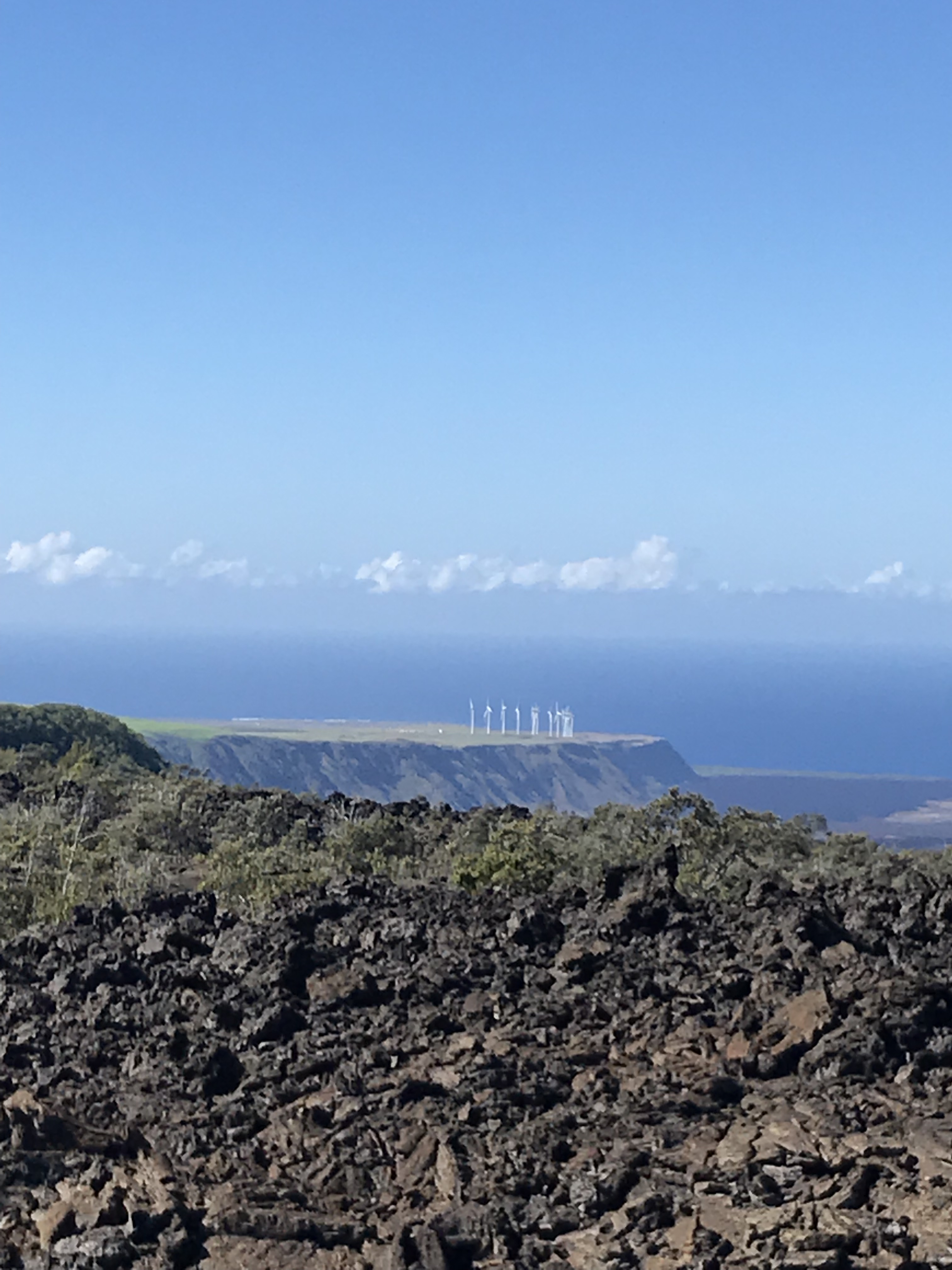
The Ocean View wind farm sits at the top of a 400′ cliff and the Pacific Ocean. South Point is out of frame and just to the left of the photo.
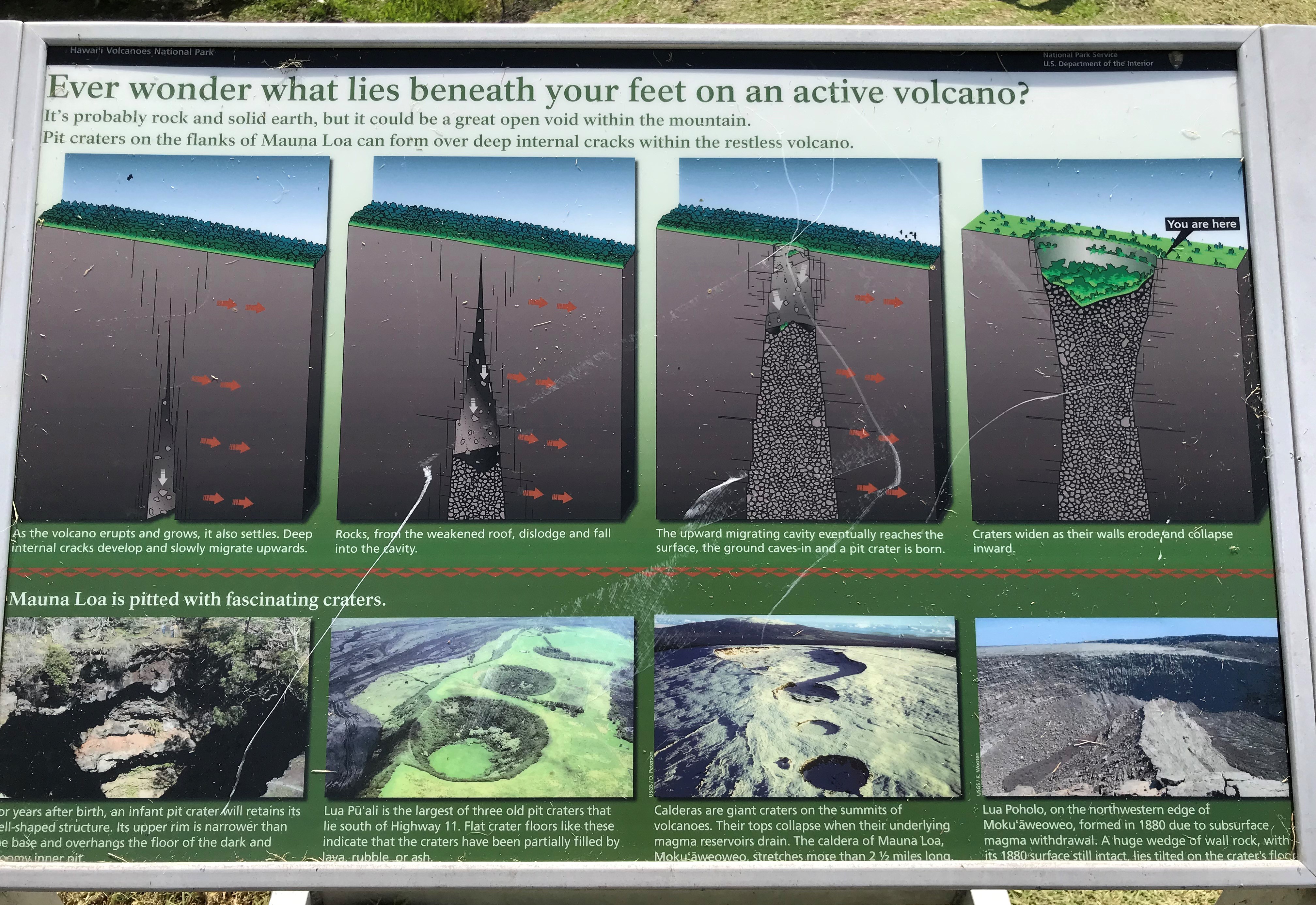
Yesterday I was able to make the last hike I had on my list to the Forested Pit Crater at the nearby Kahuku Station. Except for the Green Sand Beach hike these 4 1/2-5 mile hikes I have been by myself down, there and back. The Pit Crater hike is a 900 foot elevation change (think the first 300 feet is within a 1/4 mile of where I parked, puff, puff!!) on a recently reopened mowed trail through grassy pasture and o’hia woods. There is a fence near the edge of the crater to keep folks from leaning in so not to worry for the single hiker. Like everywhere the end result is a wonder. If I imagine the trees and shrubs stripped away in a way I can see the crater something like the quarries at home except this one is nature made and not in the inverted bell shape but the other way around.
I am captivated by Isabella Bird’s letters to her sister. She couldn’t make it to the south end of the Big Island for many reasons. Not the 1868 eruption and destruction but travel around all the islands was either by horseback, foot or canoe and anyway there was little to see. On leaving Hilo she sails around the south end though and for some reason having to do with the ferry she was traveling on had to stop along the Kona coast which gives her a few more days to explore. Other than where I am she writes of places I’ve been so there’s the hook on my attention. Her last trip to Waimea (where I visited Parker Ranch and enjoyed that delicious seared ahi BLT Sandwhich, not Earl of) she describes her experience:
What an amazing woman!
